1702:1: verschil tussen versies
k 1 versie geïmporteerd |
Geen bewerkingssamenvatting |
||
| Regel 1: | Regel 1: | ||
{{#tag:easyview|http://lh6.ggpht.com/_1AHWPR3ngw0/TSoV15lYw9I/AAAAAAAABNM/CXJEt4xAjYQ/Pistor_342.jpg|capalign=left|shadow=true|size=600|caption=Informatie afkomstig uit het Pistor archief (3.4.2) aanwezig in het [http://www.archive.nrw.de/Kommunalarchive/KommunalarchiveE-H/G/Geldern_KleveKreis/index.html Kreisarchiv Kleve]}} | |||
{{sys:kaart:semantic | {{sys:kaart:semantic | ||
|kaart={{PAGENAME}} | |kaart={{PAGENAME}} | ||
| Regel 7: | Regel 7: | ||
|cartograaf=Daniel de La Feuille (1640-1709) | |cartograaf=Daniel de La Feuille (1640-1709) | ||
|archiefstuk=http://lh4.ggpht.com/_1AHWPR3ngw0/TSR1Dg-hToI/AAAAAAAAA-Y/WCo0wXy5FUw/1702-1_01.jpg#http://lh4.ggpht.com/_1AHWPR3ngw0/TSR1E-o4-mI/AAAAAAAAA-c/3y-ArEmB9Ng/1702-1_02.jpg#http://lh4.ggpht.com/_1AHWPR3ngw0/TSR1GGaT_KI/AAAAAAAAA-g/0CeQLTbEd2w/1702-1_03.jpg#http://lh5.ggpht.com/_1AHWPR3ngw0/TSR1HeaLnjI/AAAAAAAAA-k/Vb710pXqK40/1702-1_04.jpg#http://lh3.ggpht.com/_1AHWPR3ngw0/TSR1IfcRWjI/AAAAAAAAA-o/ZWYoxogQNcU/1702-1_05.jpg#http://lh5.ggpht.com/_1AHWPR3ngw0/TSR1JtAScCI/AAAAAAAAA-s/bHB6ZduFu2U/1702-1_06.jpg | |archiefstuk=http://lh4.ggpht.com/_1AHWPR3ngw0/TSR1Dg-hToI/AAAAAAAAA-Y/WCo0wXy5FUw/1702-1_01.jpg#http://lh4.ggpht.com/_1AHWPR3ngw0/TSR1E-o4-mI/AAAAAAAAA-c/3y-ArEmB9Ng/1702-1_02.jpg#http://lh4.ggpht.com/_1AHWPR3ngw0/TSR1GGaT_KI/AAAAAAAAA-g/0CeQLTbEd2w/1702-1_03.jpg#http://lh5.ggpht.com/_1AHWPR3ngw0/TSR1HeaLnjI/AAAAAAAAA-k/Vb710pXqK40/1702-1_04.jpg#http://lh3.ggpht.com/_1AHWPR3ngw0/TSR1IfcRWjI/AAAAAAAAA-o/ZWYoxogQNcU/1702-1_05.jpg#http://lh5.ggpht.com/_1AHWPR3ngw0/TSR1JtAScCI/AAAAAAAAA-s/bHB6ZduFu2U/1702-1_06.jpg | ||
| | |archief=Pistor | ||
|archief_url=http://www.archive.nrw.de/Kommunalarchive/KommunalarchiveE-H/G/Geldern_KleveKreis/index.html | |archief_url=http://www.archive.nrw.de/Kommunalarchive/KommunalarchiveE-H/G/Geldern_KleveKreis/index.html | ||
|column=3 | |column=3 | ||
}} | }}{{sys:terug|pagina=Historische kaarten}}{{sys:kaart:overzicht|kaart={{PAGENAME}}}} | ||
[[Categorie:Cartograaf:Daniel de La Feuille (1640-1709)]] | |||
[[Categorie:Archief:Pistor]] | |||
[[Categorie:18e eeuw]] | [[Categorie:18e eeuw]] | ||
Versie van 19 nov 2020 20:15
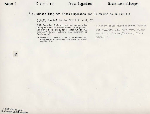 Informatie afkomstig uit het Pistor archief (3.4.2) aanwezig in het Kreisarchiv Kleve
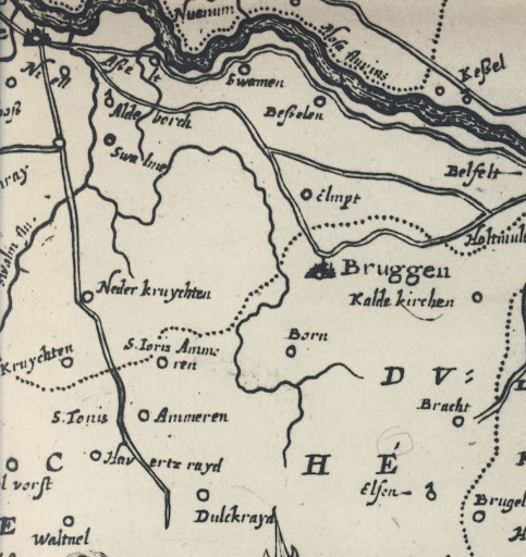
Terug naar Historische kaarten
Impressum 1702
Cartograaf Daniel de La Feuille (1640-1709)
Kaart afkomstig van Pistor