Warning: getimagesize(https://imsr2.hisgeolimburg.eu/i/ckRQ.jpg): Failed to open stream: HTTP request failed! HTTP/1.1 404 Not Found in /home/u447783683/domains/hisgeolimburg.eu/public_html/extensions/EasyView/EasyView.body.php on line 421

Warning: Trying to access array offset on value of type bool in /home/u447783683/domains/hisgeolimburg.eu/public_html/extensions/EasyView/EasyView.body.php on line 422

Warning: Trying to access array offset on value of type bool in /home/u447783683/domains/hisgeolimburg.eu/public_html/extensions/EasyView/EasyView.body.php on line 422
Kaart:1627:4: verschil tussen versies - Historische Geografie Limburg

Kaart

1627:4: verschil tussen versies

Geen bewerkingssamenvatting
Regel 2: Regel 2:
|kaart={{PAGENAME}}
|kaart={{PAGENAME}}
|impressum=1627
|impressum=1627
|cartograaf=
|afbeelding=http://lh6.ggpht.com/_1AHWPR3ngw0/TSN5ppxMAPI/AAAAAAAAA2Q/st55vurhS5A/s500/1627-4.jpg
|afbeelding=http://lh6.ggpht.com/_1AHWPR3ngw0/TSN5ppxMAPI/AAAAAAAAA2Q/st55vurhS5A/s500/1627-4.jpg
|afbeelding_groot=http://lh6.ggpht.com/_1AHWPR3ngw0/TSN5ppxMAPI/AAAAAAAAA2Q/st55vurhS5A/s400/1627-4.jpg
|afbeelding_groot=http://lh6.ggpht.com/_1AHWPR3ngw0/TSN5ppxMAPI/AAAAAAAAA2Q/st55vurhS5A/s400/1627-4.jpg

Versie van 18 nov 2020 17:33

Kaart data
Kaart 1627:4


Afbeelding 1627-4.jpg
Afbeelding groot 1627-4.jpg
Impressum 1627


Archiefstuk 1627-4_12.jpg
Archief Historischer Verein für Geldern und Umgegend E.V.
Archief_url http://www.archive.nrw.de/Kommunalarchive/KommunalarchiveE-H/G/Geldern_KleveKreis/index.html
Zoom_width 492
Zoom_height 442
Zoom_left
Zoom_top
Column 4

Terug naar Historische kaarten
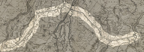
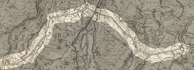
Impressum 1627

Cartograaf Johannes Janssonius (1588-1664)

Kaart afkomstig van Historischer Verein für Geldern und Umgegend E.V.